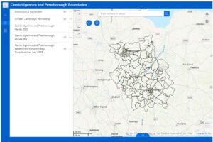
We have introduced a new page to detail the key geographies in Cambridgeshire and Peterborough. These include local authority districts, Wards, LSOAs, Westminster Parliamentary constituencies and more.
On the page we have displayed the key geographies on an interactive map as well as providing static PDF maps that you can download.
Cambridgeshire & Peterborough Insight – Key Geographies
If there are any particular geographies / boundaries that you think could be added to the map / resources then please email policyandinsight@cambridgeshire.gov.uk.